By: Christopher Arp, Water and Environmental Research Center, University of Alaska Fairbanks (UAF); and Benjamin Jones, Alaska Science Center, United States Geological Survey (USGS)
Ten years ago Christopher Arp (UAF) and Benjamin Jones (USGS) left from Barrow, Alaska, by snowmachine and headed 100 miles southeast along the Beaufort Sea coast to Teshekpuk Lake—Alaska's largest Arctic lake. Working on a project funded by the USGS, their goal was to collect data on thermokarst lakes to help address questions regarding changes in permafrost and habitat for waterbirds, such as black brant geese, which flock to the lakes and wetlands north of Teshekpuk each summer. As novices to such remote winter fieldwork they experienced numerous challenges. With much appreciated support from the experience of local guide, Ronald Aveoganna, and another USGS scientist, David Selkowitz, Arp and Jones gained insight into making such expeditions safe, successful, and a source of valuable scientific data. Being able to travel long distances to key remote sites in the winter at relatively low costs enabled the team to undertake fieldwork in northern Alaska where Arctic lakes remain ice-covered for three-quarters of the year. Whether they knew it at the time or not, this duo committed to making such expeditions a foundation of their collaborative research on lakes and Arctic landscapes. They found that to travel and experience the Arctic in the winter is to begin to truly understand the impacts climate change is having on these important ecosystems.
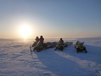
Since 2007, Arp and Jones have traveled 10,000 miles together on snowmachines in Alaska, studying lakes in regions where water often covers more of the land surface than tundra or trees. Usually in the company of other companions, these Arctic scientists have spent entire trips in deep cold, such as in early March 2009 when temperatures remained below -20°F for nine straight days. During an even more frigid trip on the Yukon-Kuskokwim Delta in March 2012, the team had to resort to body heat to thaw out 20-pound propane tanks to cook meals and warm camp tents. Wind velocity and duration are also important forces in determining trip success. The team spent nearly a week pinned down in a tent by a ground blizzard west of Nuiqsut, Alaska, in March 2013.
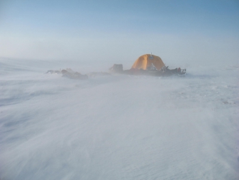
That experience provided an opportunity to appreciate the importance of wind and blowing snow in shaping the Arctic landscape. Experiencing such adventures with scientific colleagues forms essential bonds, which often translate into new hypotheses, study designs, data collection, and scientific and personal discoveries. Since 2008, these snowmachine traverses have resulted in 18 publications in peer-reviewed journals, as well as numerous datasets on lakes, snow, ice, and permafrost that will serve as a baseline to evaluate future change in the Arctic.
The repeated winter snowmachine traverses also formed the basis for two National Science Foundation (NSF) projects: the Circum-Arctic Lakes Observation Network (CALON), funded by the NSF Arctic Observing Network (AON) program in 2011; and the Arctic Lake Ice Systems Science (ALISS), funded by the Arctic System Science program in 2014 with additional support provided by the USGS, the Arctic Landscape Conservation Cooperative (Arctic LCC), and the Bureau of Land Management (BLM).
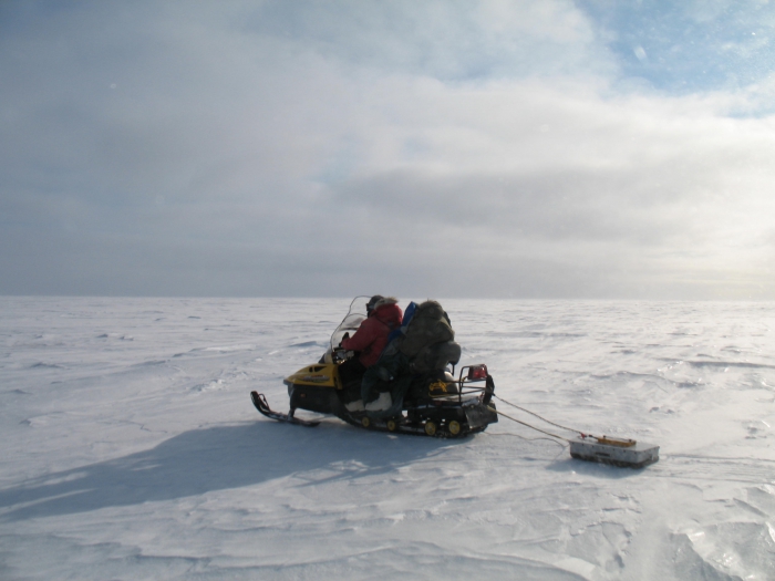
The NSF-CALON project focused on the development of a lake observation network in northern Alaska between Toolik Field Station and Barrow, Alaska. Scientists instrumented 60 lakes with various sensors that recorded information on temperature, water level, and chemistry year-round. They also visited these sites biannually, once in the spring on snowmachine and again in the summer via floatplane, to download the instruments and conduct more detailed point measurements. The baseline datasets provided by the CALON project provided insight into the annual regime of Arctic lakes along transects that spanned from the Brooks Range to the Arctic Ocean. These datasets also led to the development of testable hypotheses related to changing Arctic lakes that underscore the idea that to better understand lake-rich Arctic landscapes, winter research is required. The recently funded NSF-ALISS project specifically focuses on the eight to nine months of the year in which lakes in northern Alaska are ice-covered. Evidence indicates that thinner ice growth in response to warmer, snowier winters is pushing many bedfast ice lakes to floating ice regimes. If such a regime shift becomes pervasive across lake-rich landscapes, resulting permafrost thaw and enhanced moisture and heat flux could generate positive feedbacks, further amplifying this regime change. To study this, the scientists are using a combination of remote sensing, field surveys, geophysical measurements, experiments, and physical models to isolate processes, quantify interactions, and project changes.
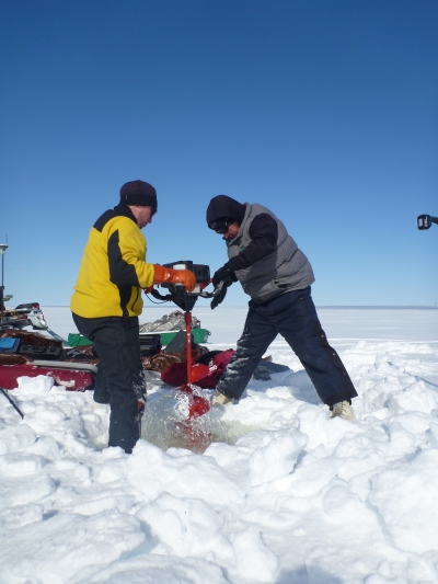
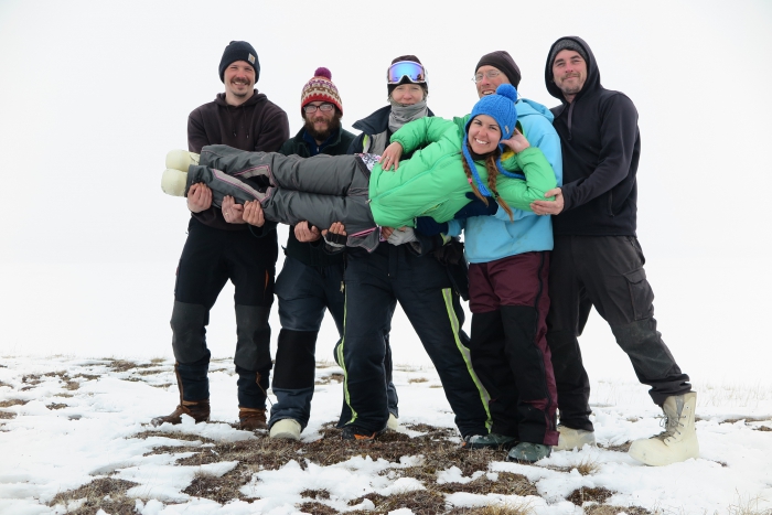
During April and May of 2016, Arp and Jones were accompanied by Allen Bondurant (UAF), Andrew Parsekian (University of Wyoming), Andrea Creighton (University of Wyoming), and Esther Babcock (USGS) on the spring ALISS field campaign. The scope of the fieldwork was intense during this 900 mile, three week snowmachine traverse from Toolik Field Station to Barrow. The team measured the depth to permafrost below forty lakes using a variety of geophysical techniques, collected lake sediment cores for lab analysis that will reconstruct ice thickness fluctuations in the distant past, ground-truthed satellite radar imagery acquired during the expedition that shows where fish are potentially overwintering, installed near real-time lake ice growth and decay buoys, and continued to build on the decade-long dataset of ice thickness and snow cover conditions on lakes in northern Alaska. Lake buoys transmit near real-time data via satellites so ice conditions can be checked daily online. Data are available on the ALISS website under the "Real-Time Data" tab.
The 2016 snowmachine expedition was particularly thought-provoking given that the team was chasing the melting snow cover northward the entire trip. The ALISS team arrived in Barrow on 6 May 2016 over a dwindling snowpack, almost ten years to the day since Arp and Jones's first research-based snowmachine expedition in the Arctic. Their arrival was just in time, as Barrow posted its earliest recorded spring snowmelt on 13 May 2016. The team is excited to study the impact that such an early break-up in northern Alaska will have on the numerous lakes that dominate the landscape.
For more information on the projects and efforts associated with their research on Arctic lakes please visit these related websites:
Arctic Lake Ice Systems Science (ALISS)
Circum-Arctic Lakes Observation Network (CALON)
Teshekpuk Lake Observatory (TLO)
United States Geological Survey (USGS)
For additional details, contact Christopher D. Arp (cdarp [at] alaska.edu) and Benjamin M. Jones (bjones [at] usgs.gov).
