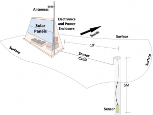
EarthScope, a multidisciplinary earth sciences research program funded by the NSF, is developing plans to deploy its Transportable Array across Alaska beginning in late 2013. The Transportable Array is a suite of 400 broadband seismic stations, which are deployed across a large-scale grid. The observatory stations are placed in a wide variety of settings and operate for two years to record continuous high-quality seismic data with precision timing. As planning continues for deployment in Alaska, the broader scientific community is encouraged to consider possible collaboration opportunities with this infrastructure to create multi-disciplinary observing stations. Collaborations might include modest additions to the sensor suite, such as a meteorological package, sample collection of soils, and thermal soil profiling on multiannual timescales.
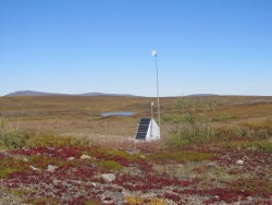
A test station is currently operating at the University of Alaska Toolik Lake Research Station.
Since 2004, EarthScope has occupied some 1,400 individual station sites with geophysical instruments, including seismometers, GPS systems, and strain meters, to better understand the structure and evolution of the North American continent and the origins of earthquakes and volcanoes. Funded by the NSF, EarthScope's three observatories -- USArray, the Plate Boundary Observatory, and the San Andreas Fault Observatory at Depth -- have recorded more than 32 terabytes of seismic data used to produce high-resolution images of the Earth's interior.

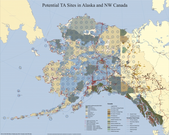
Current plans, subject to review and approval by NSF, call for deploying Transportable Array stations in Alaska beginning in late 2013. Transportable Array stations in Alaska would be arranged in a grid-like pattern with 85-km spacing and are planned to cover all of interior Alaska and westernmost Canada, including parts of the Yukon, Northwest Territories, and British Columbia. Installation of about 300 sites is projected to begin in late 2013 and the deployment phase would take over two years to complete. The stations would then operate for two to three years. Many of the proposed locations would supplement or enhance existing seismic stations in coordination with the Alaska Regional Network, the Alaska Volcano Observatory, and the Alaska Tsunami Warning Seismic System. When possible, Transportable Array stations would be co-located with existing GPS stations constructed by EarthScope's Plate Boundary Observatory. Removal of the stations would commence in 2018. To discuss possible collaborations, please contact Robert Woodward, USArray Director, 202-682-2220 extx 206 or Robert Busby, Transportable Array Manager, 1-800-504-0357 at the Incorporated Research Institutions for Seismology (IRIS).
For further information about plans to deploy the Transportable Array in Alaska, please visit: http://www.usarray.org/Alaska or the IRIS Consortium or download Transportable Seismic Network: Alaska, Opportunities for EarthScope Science in Alaska in Anticipation of USArray Final Report, Autonomous Polar Observing Systems Workshop Report, and USArray: The First Five Years.


