Assessment of Current Ice Conditions Relevant to Distribution and Access of Walrus
Click the name of each community below to view more frequently updated and detailed information from the National Weather Service.
Synopsis – A low will meander around the southwest Bering Sea through Sunday as another weak low develops over the central Bering Monday. High pressure will remain over the Chukchi Sea.
Near St. Lawrence Island
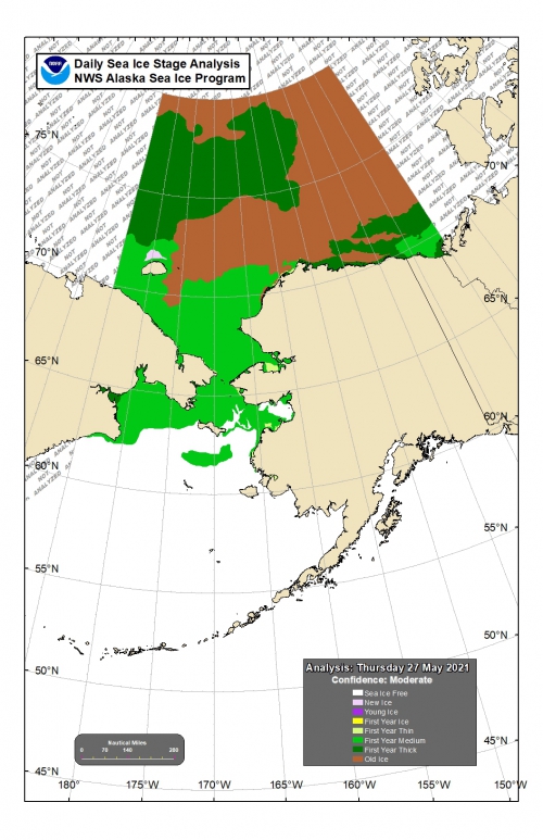
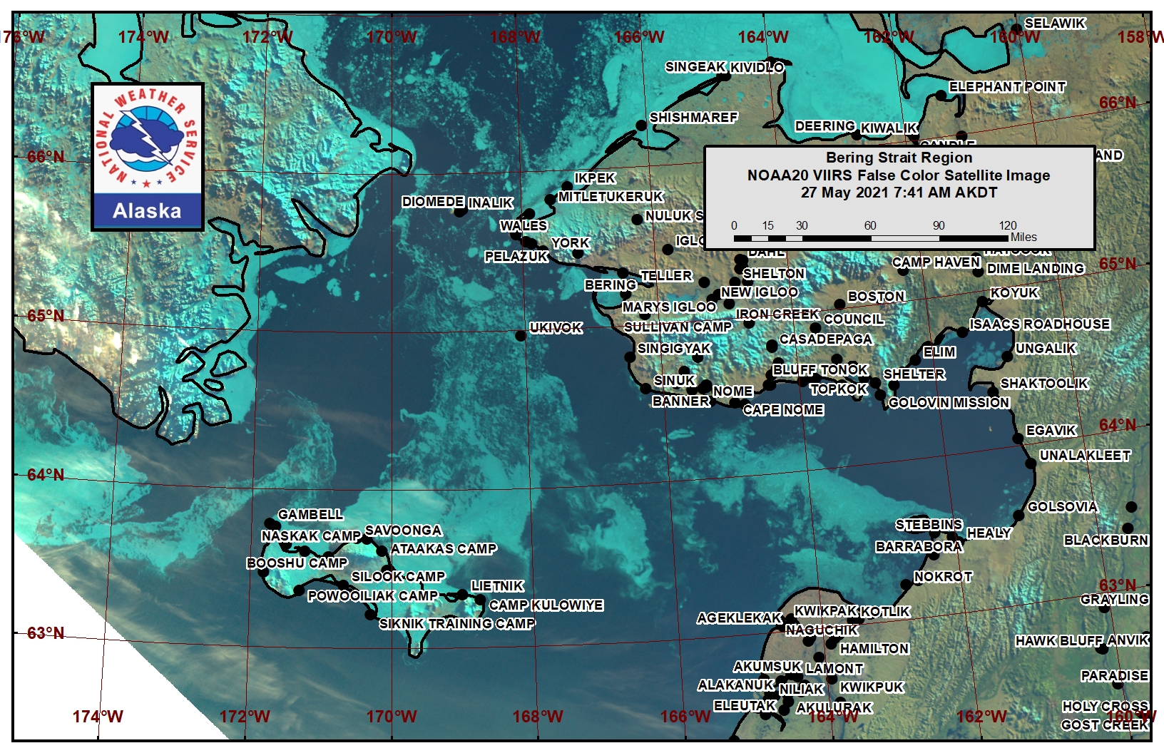
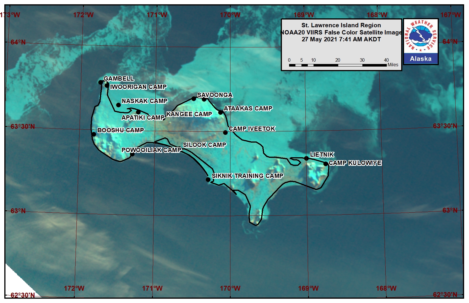
There is shorefast ice, mainly on the north side of St. Lawrence Island, generally extending 1 to 5 miles offshore. Beyond the shorefast ice on the north side of the island is consolidated to compact pack ice consisting of medium to vast floes. There is a polynya consisting of open water beyond the shorefast ice between Gambell and Savoonga that is 15 to 20 miles wide. There is open compact pack ice 10 miles west of Gambell and open water south of the island. To the east of the island is very open pack ice to open water.
Nome
There is an area of open water south of Nome, extending 10 miles offshore. Very close pack ice exists south of the open water, extending approximately 80 miles south, consisting of small ice cakes to vast floes.
Brevig Mission/Port Clarence Area
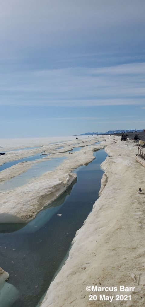
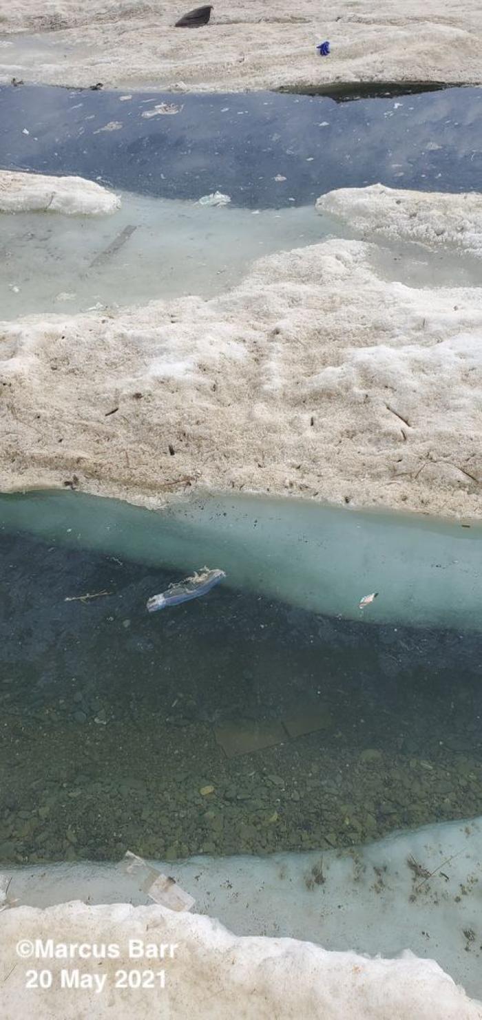
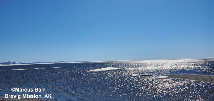
Shorefast ice remains intact and extends approximately 10 miles west/southwest of Brevig Mission. Close pack ice consisting of vast floes extends to 22 miles west of Brevig Mission. Open water with small floes extends for 25 miles beyond.
Wales to Shishmaref
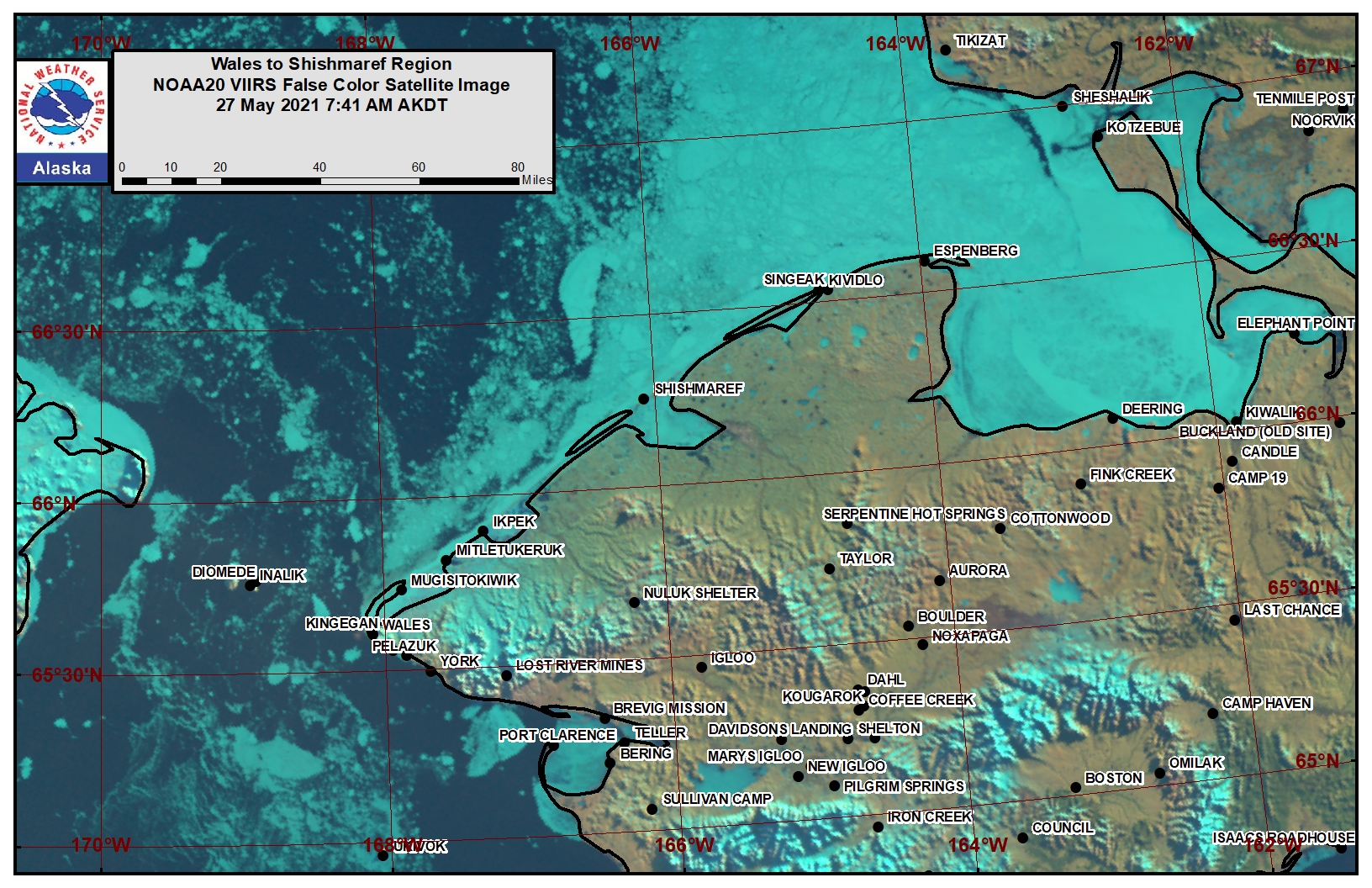
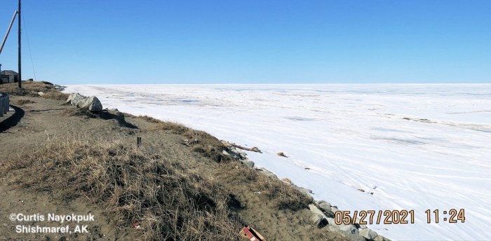
Shorefast ice extends up to 2.5 miles from the coast. Beyond the shorefast ice is consolidated ice consisting of medium to giant floes. To the west and northwest of Wales, very close pack extends up to 17 miles, with close pack ice beyond that.
Diomede
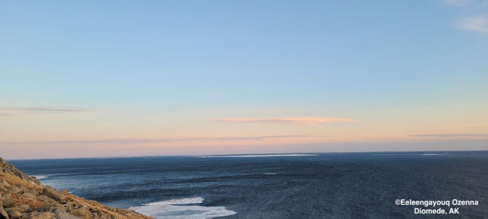
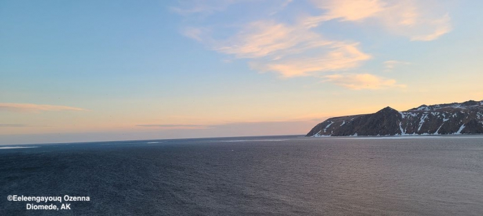
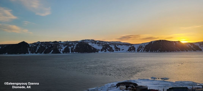
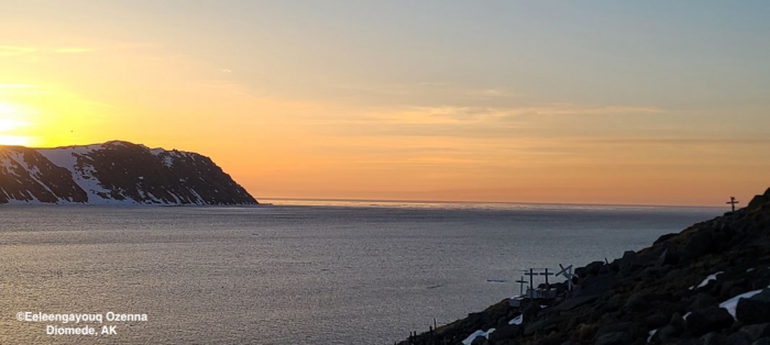
Close pack ice surrounds Little Diomede Island and extends 70 to 80 miles north and south of the island. There is an area of very close pack ice south of the island.
Forecast Discussion
Ice Forecast
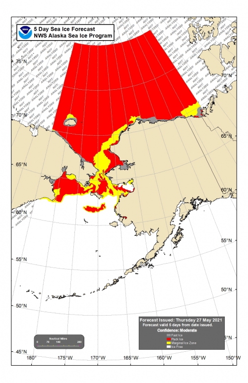
Sea ice will generally move with ocean currents through Monday, with the exception of the Bering Strait area where sea ice may drift southward if winds are stronger than the currents. Thinner sea ice between thicker ice floes will continue to melt through the week.
Wind Synopsis
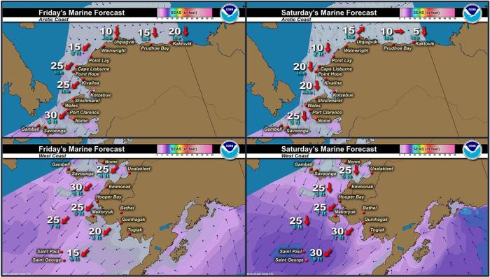
Northeast winds 20 to 30 kt (23 to 35 mph) on Friday, May 28th will persist through Sunday, May 30th, with the strongest winds from the Bering Strait to St. Lawrence Island. Winds will shift to the north-northwest 10 to 25 kt (11 to 29 mph) across the region on Monday, May 31st and persist through Friday, June 4th. The strongest winds will continue from the Bering Strait to St. Lawrence Island with much lighter winds near Nome and Shishmaref.
Temperature Trend
From Friday, May 28th through Sunday, May 30th, high temperatures will be in the upper 30's to upper 40's and overnight lows in the upper 20's to mid 30's, with the warmest readings near Nome. For the remainder for the period from Monday, May 31st through Friday, June 4th, daytime highs will be in the upper 30's to lower 50's with overnight lows in the 30's to lower 40's. Once again, the warmest temperatures will be from Teller to Nome.
Daily Weather, Wind, and Temperature Updates
The National Weather Service provides twice-daily, text only updates on the weather, wind, and temperature conditions in specific geographical zones. An interactive weather map for access to other Alaskan zones can be found here: http://weather.gov/anchorage/ice
Higher resolution satellite images and wind maps (wind updated daily) can be viewed here: http://www.weather.gov/afg/SIWO_overview
Marine forecast for the West Coast and Arctic Coast
Remote Sensing Images
Observations and Comments
Observations of Sea Ice Development
Observations from Diomede
Wednesday, 26 May 2021 – Marty Eeleengayouq Ozenna
We still have ice coming from the southwest also the flight home from Nome was nice but it looked like the ice was melting an rotting. Looked like from outside King Island all the way to Diomede and southwest long strip, also lots of coastline shore ice from berviq to past Wales an ice up north and behind Diomede and hunters waiting on the weather to get nice to shove out.
Observations from Savoonga
Thursday, 27 May 2021 – Aqef Waghiyi
Nobody been out boating in 3-4 days. Last time people went out people got mostly bull walrus and bearded seal. Back to winter here in Savoonga. Small specks of open water here and there. Pretty foggy today, couldn’t see too far.
Observations from Port Clarence and Brevig Mission
Thursday, 27 May 2021 – Marcus Barr
The channel west of Brevig is open quite a ways out and the ice near the beach in front of Brevig has got out a bit. Looks like there's a trail for boat to Teller. Ice is no longer safe to travel on. Nobody has gone out boating yet, it has been strong north winds past couple days.
Observations from Shishmaref
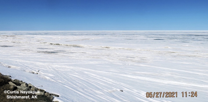
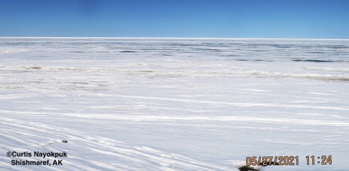
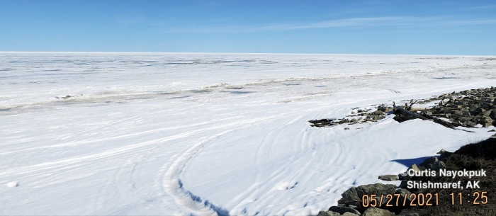
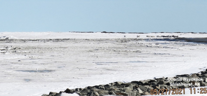
Thursday, 27 May 2021 – Curtis Nayokpuk
Couple hunters traveled by snowmobiles to "Ikpik" approx. 40 miles west between Shishmaref and Wales reported seeing only common seals. No Bearded seals seen on ice or swimming in leads they were able to reach. Local hunters’ boats ready and waiting to launch when sea ice moves out. Forecast northerly winds over Memorial Day weekend will keep loose pack ice blocked in along shore fast ice.
Observations from Gambell
Friday, 28 May 2021 – Clarence Irrigoo, Jr.
Good morning, this week no boats went out because of the weather. Very windy week and lots of ice coming from other side. The ice is getting thinner than yesterday, the ice that is coming from other side, still very windy.
Observations from Nome
Friday, 28 May 2021 – Boogles Johnson
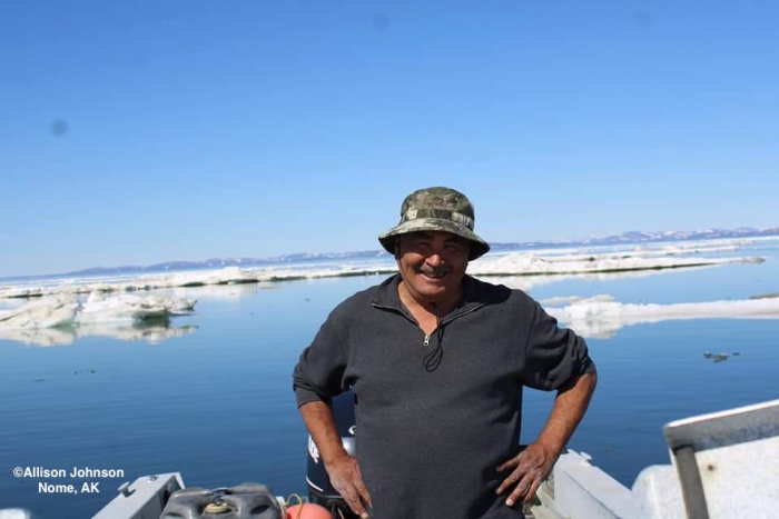
The sea ice is barely visible from the shores of Nome, I was able to go out this Wednsday and there’s still great ice to hunt on. Kevin Piscoya in this photo taken by Allison Johnson to show that we still have ice here at the end of May! The Ice seems to have drifted from south of Cape Nome west and is now South of Nome proper. We didn’t see any walrus but had a superb day on the ocean.
Additional Comments Provided by Local Experts and Other Contributors
Shared by Rick Thoman, ACCAP
Thursday, 27 May 2021
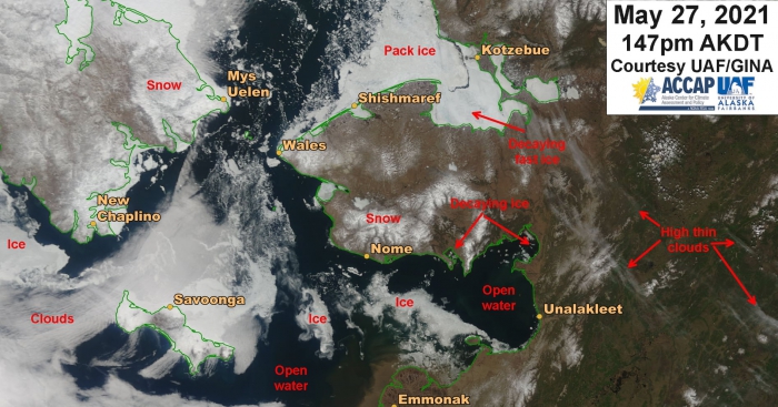
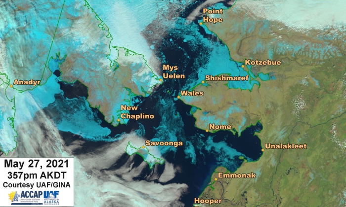
Thursday afternoon image showing continued ice movement and melt. Ice in Norton and Golovin Bay going fast. There does not look to be any fast ice left in southern Norton Sound with a northward drift of ice in western Norton Sound. NEW: The second picture was taken by a different satellite a couple hours after the first and much of the low cloud in the western Bering Strait has dissipated, leaving a good view of the ice.
