Assessment of Current Ice Conditions Relevant to Distribution and Access of Walrus
Near St. Lawrence Island
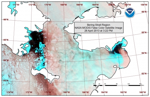
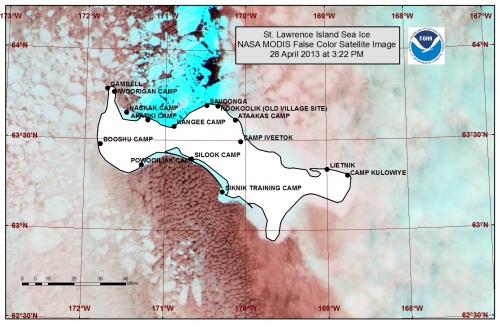
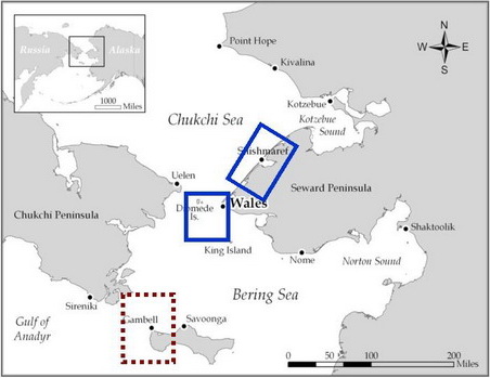
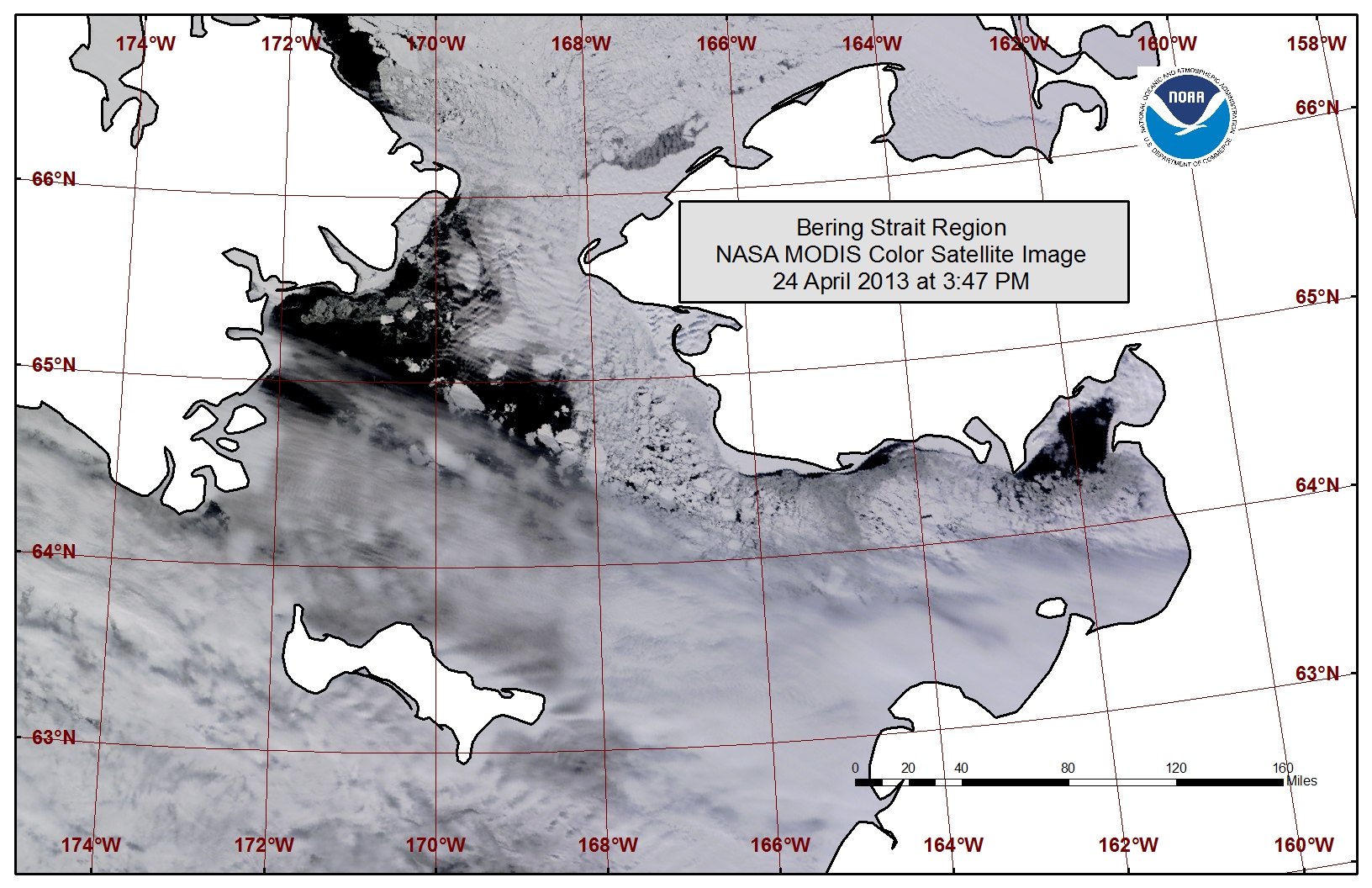
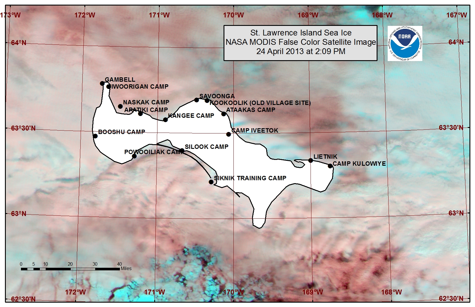
Cloud cover has been persistent over the Bering Strait region this week, providing a somewhat limited view of the sea ice near St. Lawrence, as seen in the false color image of the NASA MODIS satellite this week (pink colors highlighting clouds, bright blue highlighting sea ice). Minimal shorefast ice remains between Gambell and Savoonga and a polyna has formed off the northern coast between these two villages up to 10 miles wide. Beyond the northern coastline a polyna lies close first year pack ice. Shorefast ice remains within the barrier islands along the southern shoreline of St. Lawrence Island with close pack ice extending beyond the shorefast ice to the south.
Wales to Shishmaref
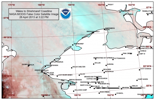
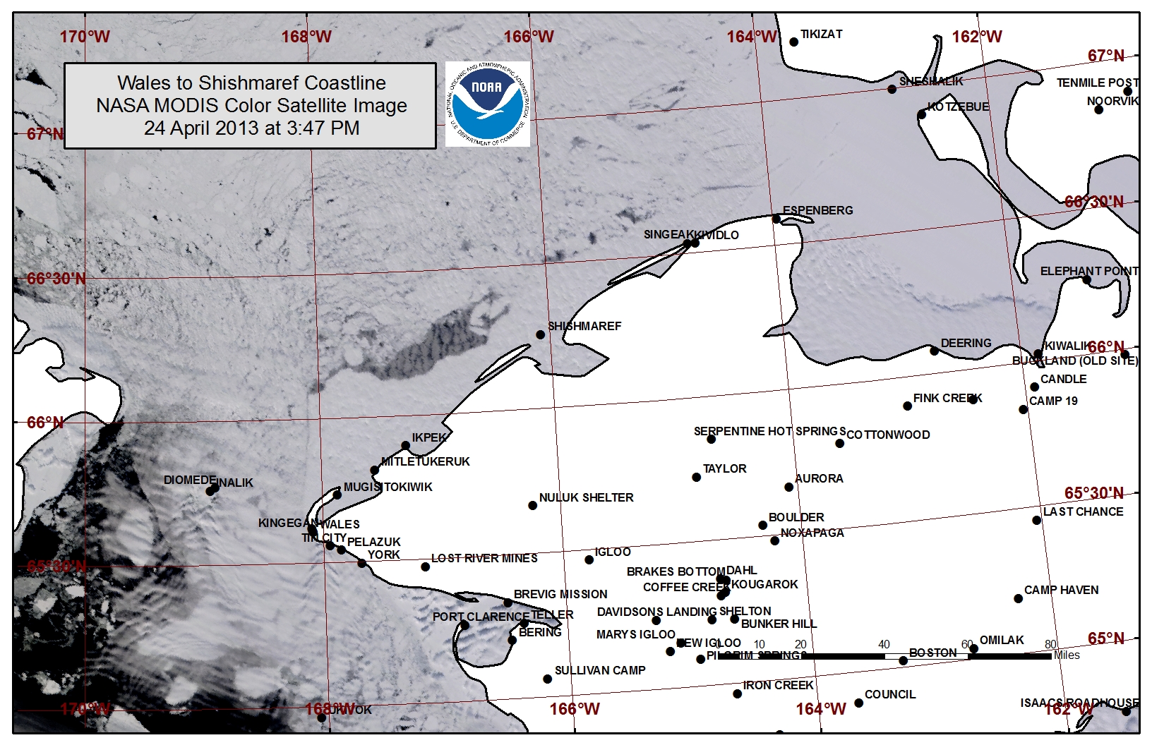
The satellite view and reports from the field suggest that shorefast ice remains stable at this time along the northwest Seward Peninsula, however the ice has been documented to be thinner than average for the past 6 years with fewer ridges present in the shorefast ice field. The shorefast ice extent along the coast varies from 8 miles off Shishmaref to 20 miles off Ikpek to 15 miles of Mugisitokiwik. Offshore flow has opened a few leads in the ice pack as well as a polyna beyond the shorefast ice between Ikpek and Shishmaref up to 8 miles wide. Very close pack ice consisting of first year thin to first year thick ice remains north of the Bering Strait.
5 to 10 Day Forecast
High pressure will remain over the Bering Sea extending into the Arctic through Wednesday, 1 May. Moderate north winds of 20 to 35 mph (15 to 25 knots) will be prevalent early this weekend due to a low pressure system moving through mainland Alaska. The center of the high pressure moves closer to the Bering Strait Sunday the 28th with winds decreasing to 10 to 20 mph (5 to 15 knots) from the northwest. Winds will remain from a northerly direction around 15 mph (10 knots) through Wednesday, May 1st. Winds will pick up from the north again at 15 to 25 mph (10 to 20 knots) late in the week as low pressure moves over the mainland again. Throughout this period, temperatures will remain at or slightly below normal. The persistent northerly flow during this period will allow the close pack ice to drift south through the Bering Strait, increasing the concentration of the ice pack between the Bering Strait and St. Lawrence Island. The polyna along the northern shoreline of St. Lawrence will close, and shorefast ice from Wales to Shishmaref may become unstable and break off along the edge as large floes of ice drift south to be transported through the Bering Strait. The northerly flow will also aid in opening a polyna along the southern coastline of St. Lawrence Island. A low pressure system will move from the North Pacific into the central Bering Sea Saturday-Monday, 4-6 May. Winds will diminish before becoming east-southeast at 10 to 20 mph (5 to 15 knots) with some warmer temperatures arriving in the area. As winds become east-southeast the polyna off the southern coastline of St. Lawrence Island will close, and ice drift through the Bering Strait will decrease.
Arrows show wind direction and wind speed in knots


Remote Sensing Images
Observations and Comments
Observations of Sea Ice Development
The NOAA/NWS Sea Ice Desk contributed additional satellite imaging with slightly clearer conditions, dated 28 April 2013:
