Assessment of Current Ice Conditions Relevant to Distribution and Access of Walrus
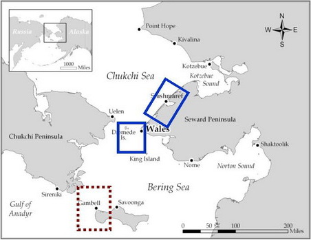
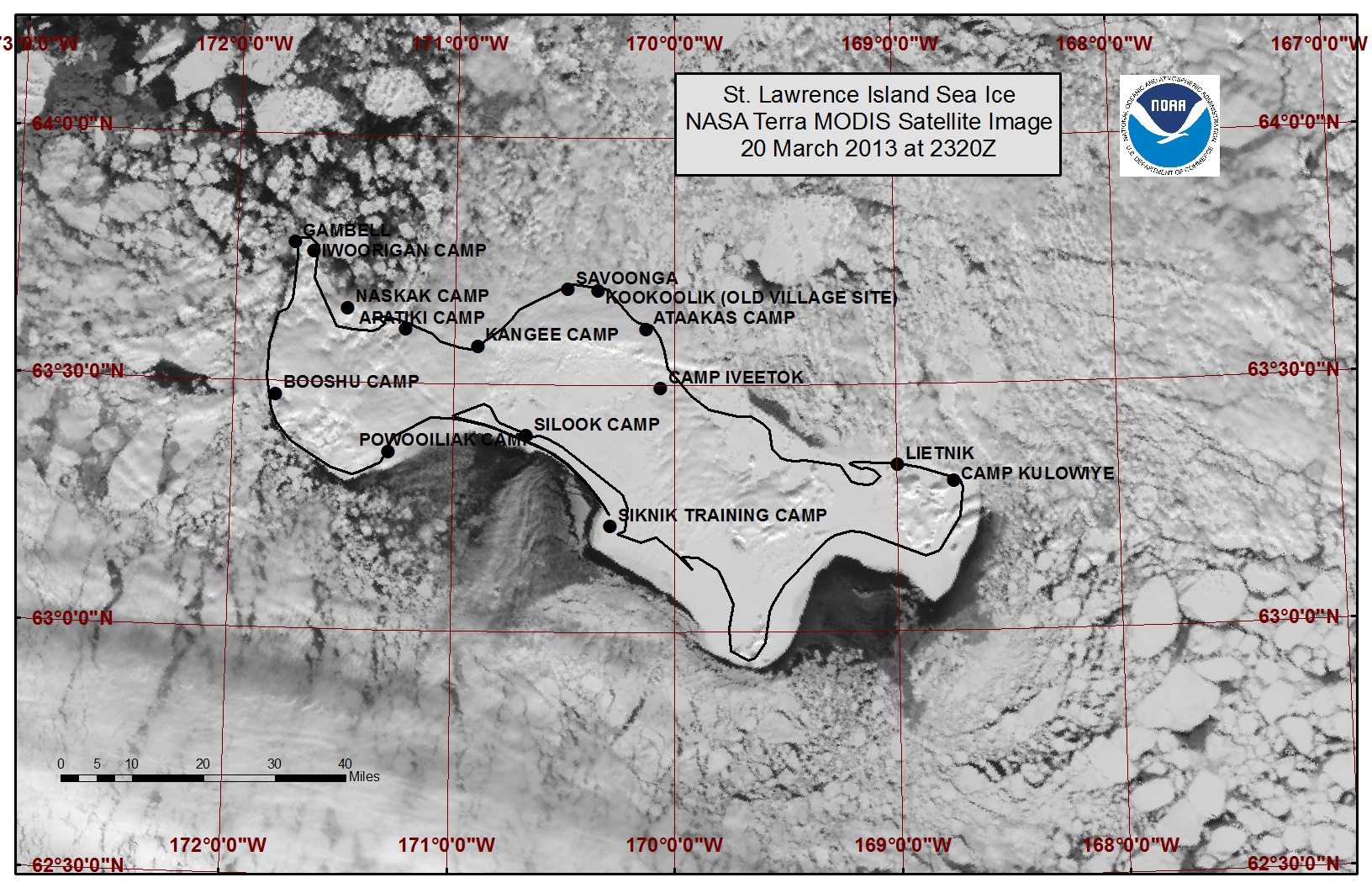
St. Lawrence Island
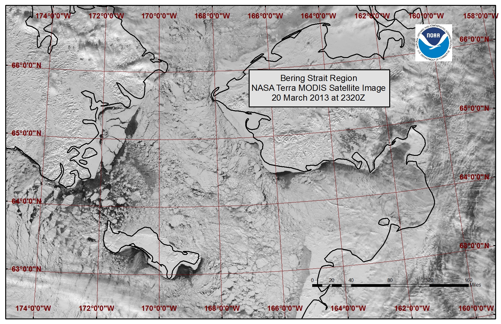
Satellite imagery shows extensive sea ice surrounding St. Lawrence Island, however the shorefast sea ice area is limited this year compared with the shorefast sea ice extent in early April of 2012 and 2010. Northerly winds have closed in the polynya beyond the northern coastline shorefast ice edge with large floes of tightly packed sea ice. Off the northwest coast near Gambell lies a region of numerous thick broken floes with high concentrations of young and new ice filling in between the floes. Northerly flow has also opened the polynya off the southern and southeastern shorefast ice edges, as seen in the satellite images from March 20th.
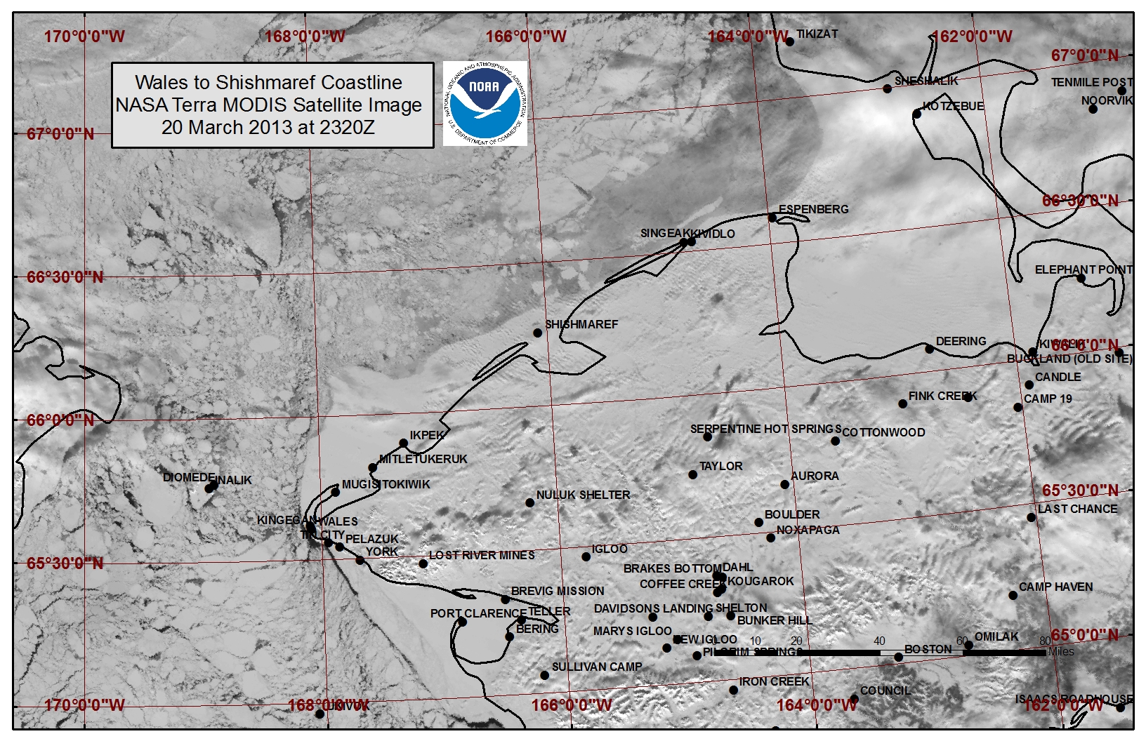
Wales to Shishmaref
Beyond the shorefast ice within Kotzebue Sound lies a large polynya that has frozen over with new and young ice. The extent of the polynya reaches roughly 15 miles northeast of Shishmaref and 7 miles offshore of Shishmaref. The shorefast ice extent along the coast varies from 6 miles off Shishmaref to 23 miles off Ikpek to 12 miles off Mugisitokiwik. The sea ice near the Bering Strait is fairly compact with numerous large floes.
5 to 10 Day Forecast
Air temperatures are expected to remain well below freezing during this time period. A low pressure system will move over interior Alaska with high pressure building over eastern Siberia Friday the 22nd causing an increased pressure gradient and northerly flow through the Bering Strait through Saturday the 23rd. Wind will be out of the North to Northwest at 10 to 20 knots. High concentrations of the thick sea ice floes will have limited movement due to the current sea ice extent in the Bering Sea. Colder temperatures through the week will increase the thickness of new and young sea ice areas. Winds will decrease to less than 10 knots Wednesday then increase to 20 knots out of the northeast near St. Lawrence island Thursday as a Low pressure system tracks into the southern Bering Sea. The winds will build to 10 to 20 knots from the northeast to northwest throughout the area from St. Lawrence through the Bering Strait into Monday, April 1. Overall there will be minimal ice floe movement during this period due to the heavy sea ice concentrations and the extent of sea ice in the Bering Sea.
Arrows show wind direction and wind speed in knots


Remote Sensing Images


Observations and Comments
Observations of Sea Ice Development
Comments from Nome
22 March 2013 - Fred Tocktoo, NPS
This year (2012-13) ice appeared relatively late, as more common in recent years, with shorefast ice forming in late December. By January shorefast ice was in place for distances up to at least a mile and a half from shores south of Nome. Ice is moving around beyond two miles out from the shoreline. The rivers froze in late October or early November this year. Snow came much later in late December. Presently, our shorefast ice is set up and in place but ice movement is active just beyond the edge of the shorefast ice.
