Assessment of Current Ice Conditions Relevant to Distribution and Access of Walrus
Near St. Lawrence Island
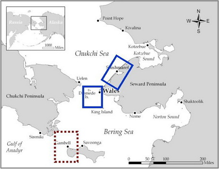
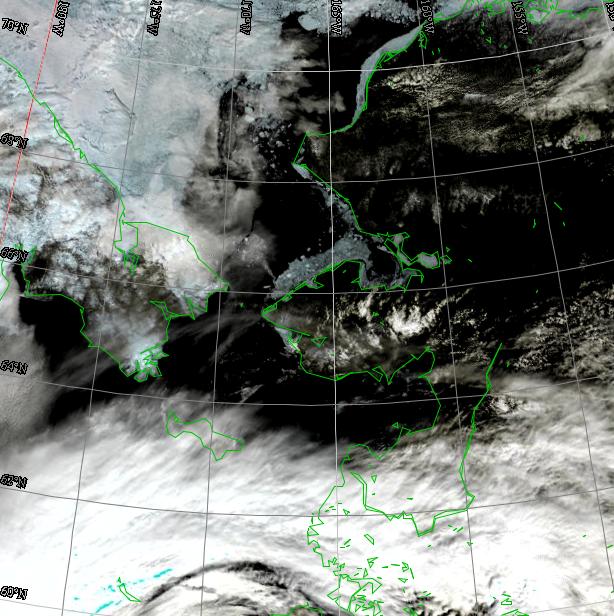
The sea ice in the northern Bering Sea has been dissipating rapidly for the last week. Shorefast ice is breaking away from the coast in many areas. There is some shorefast ice east of Savoonga with 2 to 4 tenths concentration of broken and jumbled ice just offshore of the shorefast ice. Shorefast ice is still present along the southeast shoreline of the island. Much of this is due to a big storm bringing gale force winds to the area. Not much more can be said for the ice near St. Lawrence Island because of the consistent cloud cover from that storm hiding the ice in the satellite imagery, however, melting and dissipating sea ice will continue.
Wales to Shishmaref
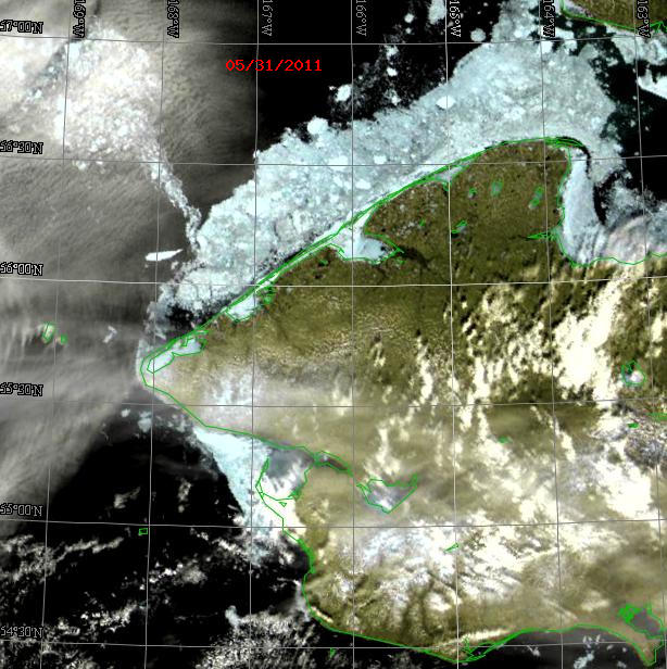
Satellite imagery shows that the persistent easterly winds that have been occurring are breaking up the shorefast ice both south of Wales and offshore of Shishmaref. These easterly winds should continue through Saturday, 4 June. This will continue to push the ice away from the shoreline. Offshore of Wales there are many stringers of small ice floes streaming toward the west. Here, too, the sea ice will continue to melt and drift out of the area.
5 to 10 Day Forecast
The big storm in the central Bering Sea is rapidly weakening. Winds over the region will decrease to approximately 10 knots, east, by Sunday, 5 June. A new low will move along the Aleutians, eastward, starting Monday, 6 June. It will not be strong enough to affect the northern Bering Sea area. Winds should be mostly northeasterly with speeds around 10 knots through 13 June, and seas less than 4 ft in open water areas.
Arrows show wind direction and wind speed in knots


Remote Sensing Images
Observations and Comments
Observations of Sea Ice Development
6 June 2011 - Hajo Eicken; researcher, University of Alaska Fairbanks
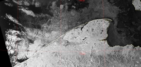
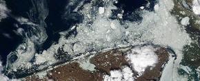
A radar satellite image (Envisat provided through PolarView) for 6 June shows the patterns of landfast ice breaking up along the coast between Wales, Shishmaref, and Kotzebue Sound. While radar satellite imagery can see through clouds, as commented by Fred Tocktoo, Nome (see comment below), visible range imagery such as MODIS obtained through GINA or from the NWS is more useful under cloud-free conditions. In summer, the presence of surface melt water (see photos posted by Curtis Nayokpuk, below) reduces the contrast between ice and open water in radar images; also, as a direct comparison shows, radar imagery typically does not provide as much detail as MODIS. However, radar images are much better in detecting deformed ice, and ice of different age, as illustrated by the ALOS PALSAR images shown earlier in the season.
Fred O. Tocktoo - Subsistence Ranger, Western Arctic National Parklands
Current satellite images, (see satellite image in C. Nayokpuk's comment, below), are good safety measures and help save hardship and lives. This is particularly true for our hunters using small, open, motorized boats, because they can see which areas might be dangerous and then avoid any specifically ice-congested areas, where some boats may get boxed in and be unable to reach safety; this has happened in the recent past.
6 June 2011 - Curtis E. Nayokpuk; local observer in Shishmaref
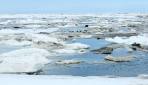
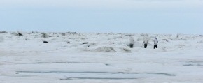
As of this morning all hunters are back on shorefast ice due to west and NW winds moving ice in and limiting boat travel. No access to deeper water for walrus.
3 June 2011 - Winton Weyapuk Jr.; local observer in Wales
There has been very little pack ice going by near Wales lately. During the past two days there has been a thin strip of what could be broken shorefast ice drifting north near the edge of the shorefast ice. If there are walrus they would most likely be with any scattered small packs of ice or in pack ice north of the Diomede islands.
When shorefast ice becomes too rotten to travel over safely, it usually breaks up in about a week to two weeks. As seems to be the case now, the remaining pressure ridges may keep the shorefast ice in place until it literally rots apart. In the past, two to three weeks of waiting for the shorefast ice to open a path has been typical. Hunters are usually out as soon as a path opens through the shorefast ice, even in fairly breezy northeasterly winds, as long as they can hunt along shorefast ice or broken shorefast ice to the north.
UPDATE 3 June 2011, 3:15 p.m.
The shorefast ice did break up along Cape Mountain all the way to the beach this morning, with about a 1/3 mile wide opening. Hunters will most likely be out as soon as winds are lighter and fog clears over the strait.
31 May 2011 - Curtis E. Nayokpuk; local observer in Shishmaref

Easterly winds in the next two days favor the pack ice moving off/opening next to shorefast ice, but there will be just a 1-2 day window to hunt before westerly winds and current moves the pack ice back in.
